DSE Disturbance Toolbox
A suite of tools for post-fire decision support, developed in partnership between UC Berkeley’s Eric and Wendy Schmidt Center for Data Science and Environment and the National Park Service.
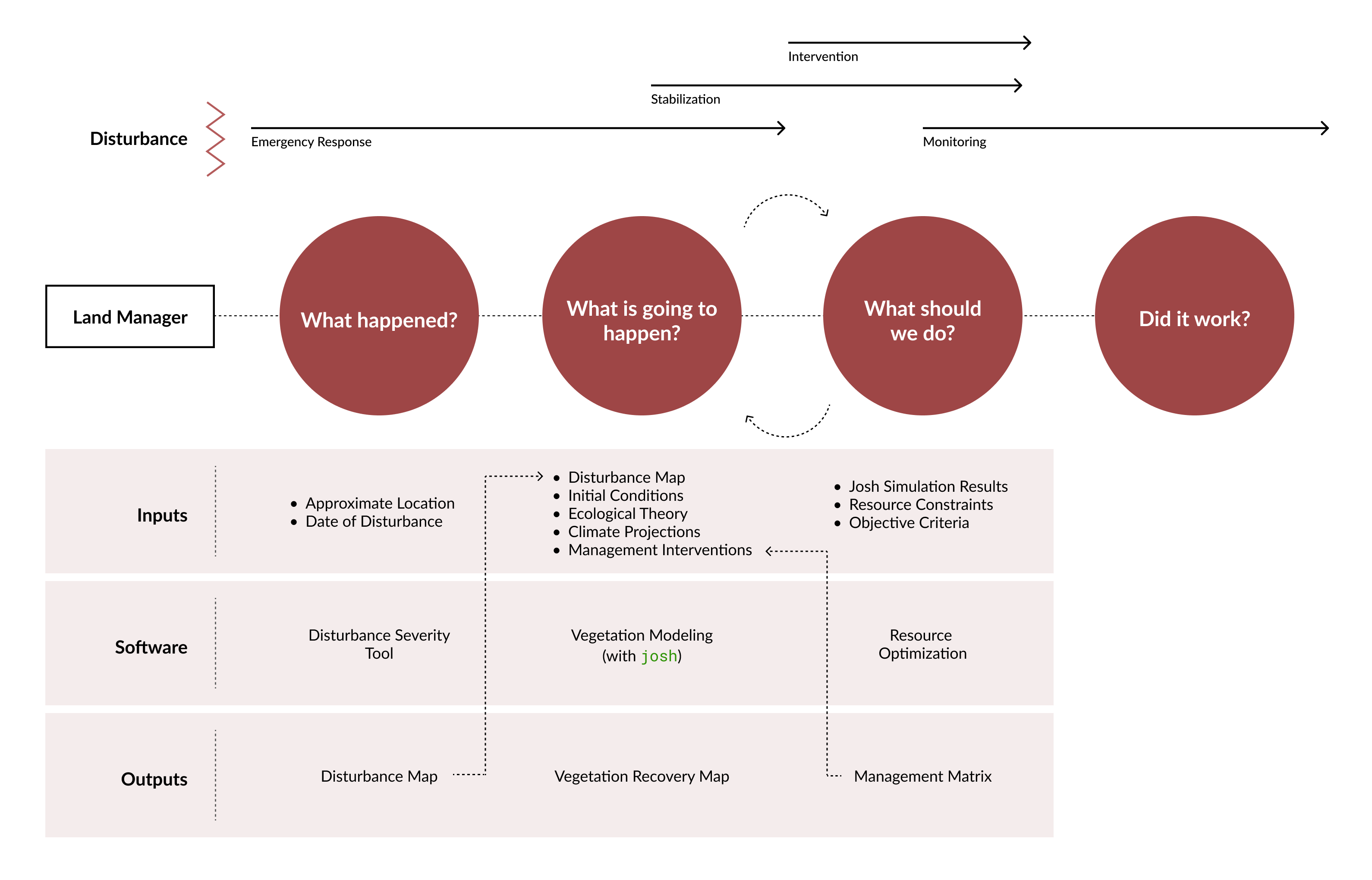
 Disturbance Severity
Generate burn severity maps from satellite imagery
 Vegetation Modeling
Simulate recovery trajectories with josh
 Resource Optimization
Compare intervention strategies under constraints
NPS park managers confronting ecosystem vulnerability in a changing climate must navigate academic literature, expert opinion, inventory and monitoring data, research results, and public input when making decisions regarding vegetation management—especially post-fire or after other large-scale disturbances.
This toolbox synthesizes these information sources to support managers in making resource-efficient decisions regarding post-disturbance vegetation management:
- Assess disturbance severity from satellite imagery, with metrics calibrated for low-biomass environments
- Project vegetation recovery under different climate and management scenarios using process-based simulation
- Compare intervention strategies under real-world constraints like seed availability, labor, and budget